Total Carbon Estimation in African Mangroves and Coastal Wetlands in Preparation for REDD and Blue Carbon Credits
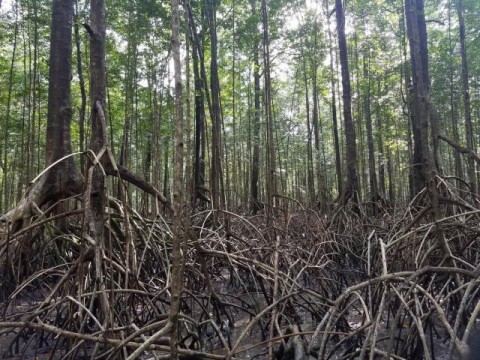
We are using a suite of commercial off-the-shelf datasets to estimate forest biomass, extend and cover change over time, including airborne LiDAR, Synthetic Aperture Radar (SAR) and Very High Resolution optical (VHR). Our methodology takes into account that most MRV systems require repeated measurements of carbon stocks and acquiring airborne lidar data on a regular timeframe is costly and impractical. We are using the most advanced 3-D remote sensing technology - Polarimetric Interferometric SAR or Pol-InSAR - as an operational technology that can augment, or even replace, costly acquisitions of Lidar data for MRV activities. Our 3D mapping methodology quantitatively characterizes forest structure and extent as well as change over time and to inform the field measurements site stratification and location. Our research strategy consists in using the airborne lidar to upscale field estimates of biomass to a larger scale and enable validation of TanDEM-X derived estimates of canopy height and biomass. We are developing a present day mangrove extent map using Landsat, SAR (ALOS-2) and Very high Resolution commercial optical data then adapt global forest change mapping algorithms to include mangrove forests and develop a timeseries of mangrove change in all three countries from 1990 to the present day. Finally, we have coordinated a Mangrove Carbon Working Group composed of in-country and US experts to coordinate, disseminate and inform field, remote sensing and GIS experts on the use and generation of the data products from this study.