
Linking carbon and water dynamics in the pursuit of predicting peat collapse in coastal blue carbon wetlands
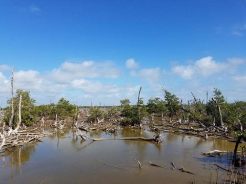
Mangroves and coastal wetlands are some of the most carbon dense ecosystems around the world. The locations of these ecosystems along coastlines make them susceptible to areas of population growth and projected sea level rise. At the current rate of sea level rise, ~3 mm per year, and the reported acceleration in sea level rise, coastal wetlands are and will be exposed to longer inundation periods that cover larger areas. Compounding factors such as tropical storms, temperature extremes, rainfall uncertainty, and reduced downstream freshwater flows can amplify the effects of saltwater intrusion leading to rapid changes in the above and below ground environments. Increased salinity and inundation can lead to alterations in biogeochemical cycles, soil microbial activity, osmotic stress, plant production and community dynamics all of which influence the stability of the organic-rich soils and carbon cycling. The main objectives of this study are to develop and apply new remote sensing modeling techniques to identify the vulnerability of peat collapse as a result of saltwater intrusion and increased inundation. Ultimately, improving the assessment of blue carbon sequestration prediction and modeling any shifts in the storage or emissive capabilities of carbon from peat soils.
Project Sponsor:
Website: