GEOG Faculty selected for NASA ICESat-2 Science Team
Geographical Sciences Faculty, Dr. Sinead L. Farrell and Dr. Laura Duncanson, were among those recently selected by NASA to serve as members of the NASA ICESat-2 Science Team.
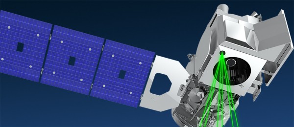
The Ice, Cloud, and Land Elevation Satellite-2 (ICESat-2) is the 2nd-generation of Earth-orbiting laser altimeters, which was launched in September 2018 to precisely measure Earth’s elevation. ICESat-2 quantifies changes in the height of Earth’s ice sheets, sea ice, forests and more, in unprecedented detail. The satellite mission has four major science objectives:
- Measure melting ice sheets and investigate how this effects sea level rise,
- Measure and investigate changes in the mass of ice sheets and glaciers,
- Estimate and study sea ice thickness,
- Measure the height of vegetation in forests and other ecosystems worldwide
Farrell and Duncanson’s research proposals were two of 24 selected by NASA, out of a pool of 96 submissions. Farrell will serve as a science team PI (principal investigator), with research focusing on advancing knowledge of sea ice properties and processes with ICESat-2. Farrell’s primary goals are to investigate recent and widespread changes in the thickness of Arctic sea ice, and improve understanding about the factors driving these changes. Duncanson serves as Co-I on a project to estimate boreal-wide forest biomass density with ICESat-2. This research expands upon another recently funded proposal under the NASA Terrestrial Ecology ABoVE program titled “Mapping boreal forest biomass density for the ABoVE domain circa 2020 with ICESat-2” led by Dr. Duncanson (PI) and Dr. Neuenschwander (Co-I).
The first major results from NASA's ICESat-2 mission were released in a new study published in the journal Science on April 30, and map 16 years of melting ice sheets. NASA ICESat-2 data can be accessed at the National Snow and Ice Data Center and visualized at Open Altimetry.
Image credit: NASA Goddard Space Flight Center
Published on Mon, 05/04/2020 - 15:53


