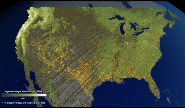
GEDI Data Will Aid NASA, US Forest Service in Quest to Count and Map America's Oldest Trees
According to Earth Week press releases published by the United States Department of Agriculture and NASA, data from the Global Ecosystem Dynamics Investigation (GEDI)—for which Department of Geographical Sciences Professor Ralph Dubayah acts as Principal Investigator—will be used to help scientists better understand some of the United States' oldest forests.
The NASA-U.S. Forest Service partnership will ultimately enhance the Mature and Old-Growth Forest report originally created by the U.S. Forest Service in response to President Biden’s Earth Day 2022 Executive Order. The highly accurate forest height, structure, and surface elevation data GEDI obtained using a laser measurement method called Light Detection and Ranging (lidar) from its spot on the International Space Station will be incorporated into the report's initial insights.
Dubayah said in NASA's press release: “It’s a really revolutionary time we're living in right now with all these different sets of remote sensing data that are already in space or going into space. This is radically changing how we go forward in these kinds of endeavors.”
Photo of visualization of GEDI data representing an old growth forest provided by NASA’s Scientific Visualization Studio
This article was first published by BSOS.
Published on Thu, 04/20/2023 - 17:07


