Dr. Chengquan Huang Quoted by New York Times Article, Emphasizing Importance of Spy Satellite Data for Better Prediction of Future Changes
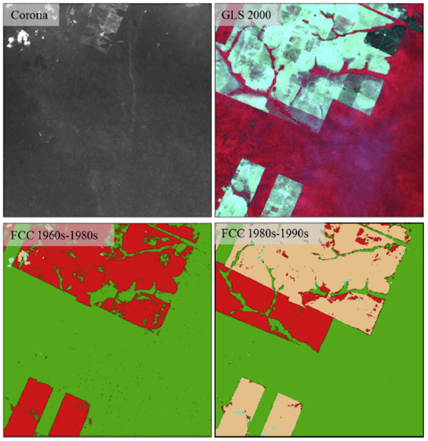
Forest change records derived using modern satellites (e.g., Landsat) can only go back to the 1980s (at 30 m resolution) or 1970s (at 60 m resolution). However, large changes might have occurred in the previous decades in many regions of the world. Back in 2015, Geographical Sciences student Danxia Song (supervised by Drs. John Townshend and Chengquan Huang) published one of the earliest studies demonstrating the usefulness of declassified spy satellite data for extending forest change records from modern satellite data back to the 1960s. Due to technological limitations at that time, the spy satellite data lacked the high geometric and radiometric qualities of modern data; hence it is still not widely used in land change studies. A recent New York Times article provided a review of the spy satellite program and highlighted some of the uses of the collected data in recent studies. In that article, Dr. Huang pointed out the importance of a longer record from the declassified satellite data for studying future changes.
The New York Times article is available from https://www.nytimes.com/2021/01/05/science/corona-satellites-environment.html. Below is a citation to the paper published by Danxia Song:
Song, D.-X., Huang, C., Sexton, J.O., Channan, S., Feng, M., & Townshend, J.R. (2015). Use of Landsat and Corona data for mapping forest cover change from the mid-1960s to 2000s: Case studies from the Eastern United States and Central Brazil. ISPRS Journal of Photogrammetry and Remote Sensing, 103, 81-92.
Published on Mon, 01/25/2021 - 12:08


