Case made for time-critical ICESat-2 data to support safe navigation in ice-covered waters
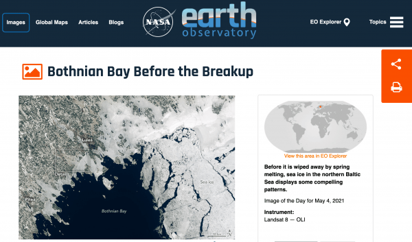
NASA's Earth Observatory Image of the Day on May 4th, 2021 features sea ice in the Bay of Bothnia, in the northern Baltic Sea. The imagery shows land-fast sea ice still clinging to the coast of northern Sweden. Drift ice, which moves freely with the winds or currents, is seen further out in the Bay. Sea ice in this region provides an important habitat for wildlife, and is also used as a platform by people to access the bay’s archipelagos. New research just accepted for publication in The Cryosphere demonstrates how high-resolution topographic measurements from NASA's ICESat-2 satellite can be used to estimate the degree of ice deformation in sea ice located in the Bay of Bothnia. The study makes a case for the rapid, near-real-time release of ICESat-2 data to advance navigation aids for safe transportation through ice-infested waters.
Published on Mon, 05/03/2021 - 21:09


